This is the personal trip report of our Director of Finance and Operations, Kurt Achtenhagen. In September of 2014, Kurt went after the fastest known time, "FKT", on the John Muir Trail. Read on to find out how it all went…
Friday, September 5th, , 2014:
I fly into San Francisco a little after 5:00 pm, pick up my rental car, and swing by friends in San Mateo. I had shipped my hiking poles and bear canister filled with food to avoid carrying it on the plane. After a quick visit, I am on my way to the high country. I arrive in Tuolumne Meadows a little after 11 pm, and am lucky to find a camp site still available. Ten minutes later I am lights out in the sleeping bag that I have on loan as a demo. I always love the opportunity to sleep out; and enjoy falling asleep to clear skies.
I awake at 2 am, absolutely freezing! The forecast called for a nightly low of 42, and the demo sleeping bag is supposed to be rated to 46. I have long underwear and a fleece hat on. A little worried, I crawl into the back of the rental car and sleep until 6:20 am.
Saturday, September 6th:
I am relieved to see the car thermometer say 34° as I pull out of the Tuolumne Campground. The nightly low forecast was obviously off, but if that is the trend for the coming days, I might be in trouble!
I pack up, and head to the Mobil Station in Lee Vining for one of their awesome breakfast burritos and a cup of coffee. If you haven’t been there, don’t laugh at my love of food coming from a gas station. This is no ordinary gas station restaurant, and has become a mandatory stop when on the east side of the Sierra.
On the way south, I detour to Reds Meadow, for a run thru on the section of trail where I got lost last year. I feel having my eyes on the trail will help greatly. I end up enjoying myself a little too much being on the trail, and cover 13 miles hiking and running. More than I intended.
Next, I head to Whitney Portal to leave my rental car at the southern end of the John Muir Trail. I arrive around 2pm, and after a final packing of my backpack, I head for the road and stick out my thumb. I feel rushed, although I am on no ones timeline but my own. Six rides, and a sum total of about 20-30 minutes of waiting later, I am back in Tuolumne Meadows by 6pm. Hitch hiking on the East side of the Sierra has always been good to me. Yet, it is always a balancing act between trusting the universe and wanting to control my destiny. There are some apt metaphors for living life here!
Earlier in the day, while running near Reds Meadow, I made the call to stay at the Tuolumne Lodge tent cabins. I felt that a warm and sound night of sleep was important! I’m in bed by 8 and sleep until 6:30. Phew, I needed that!
Sunday, September 7th:
After a leisurely lie-in, I get out of bed around 7:30 and start a fire in the small woodstove in my tent cabin. I walk down to the lodge and grab a cup of coffee. When I return to my tent cabin, it is noticeably warmer, yay!
As I was laying in bed this morning, my phone battery went from 66% down to 20% in less than 5 minutes. I chalk it up to the cold, but am worried! I had made the decision to use only digital maps, and left the paper copies in the car at Whitney Portal. After charging the phone for a bit, I head out for a walk to stretch the legs and preview the trail as it skirts along the south side of Tuolumne Meadows campground. Last year, as I undertook the same adventure, I took the trail on the North side of highway 120. General consensus is that the trail on south side, not crossing over the highway is preferable, and I would totally agree.
On my way back, I stop in at the Backcountry office. Picking up my permit is a pretty straight-forward affair, having reserved it 24 weeks in advance. The backcountry rangers have definitely seen it all, and when you say you are going for 4 days, they don’t bat too much of an eye. Greg, who is helping me, nails all the important backcountry leave no trace pieces. I always enjoy seeing these folks in their element. Permit in hand, I head over to check out of the Tuolumne Lodge and get a final battery charge on my phone.
I grab a really late breakfast at the Tuolumne Grill, and head to a quiet spot on the Tuolumne River to find a calm space to dial in mentally on the days ahead, and to finish some alterations to my backpack. I am truly feeling at ease right now… like everything is coming on line!
I am sitting for a little over an hour, and the amount of smoke from the existing smoldering fires seems to be increasing dramatically. I decide to head back to the permit office, to make sure none of the existing slow burning fires are anywhere near the trails I will be traveling.
Ack! As it turns out, there is a new fire in Little Yosemite Valley. The Park Service is closing a stretch of trail near the JMT, but nothing infringing upon the JMT at this point. Not good, but not impactful yet!
I catch the 2:15 hikers bus down to the Valley. It is a new bus, and I am happy to plug in and get a complete charge on my phone. But I am not at all psyched with the views of smoke now pouring over Clouds Rest (adjacent to Half Dome). The canyon I am to travel up in about 12 hours is filled with smoke!
The fire is now officially huge! You can see smoke everywhere, and from afar the cumulus type clouds it is generating are incredible. First stop when my bus gets to the Valley is the Wilderness Center. Bad news! The John Muir Trail heading out of the Valley is closed! Really?! You plan and train, and plan and train a whole lot more, and just like that, the game is changed, and you get no say in the matter?! Ack!
The Wilderness Center is filled with folks with Half Dome permits now finding out that their hike will never start. I don’t envy the backcountry rangers working the office this day, and damn, there will be no official JMT record for me!
I call my girlfriend, who in a quick instant, sends me on a path of reconnecting with why I am doing this. Certainly I had an eye on the record, and I certainly thought it was within reach. But ultimately, it is the beauty found in the high country, and looking in the “mirror” while pushing myself that are the real drivers here.
The Why:
Ok, that is a huge subject line. The “why”, in reality, is easier to convey more than it is to put words to it. I love to go big, push hard, and I love the High Sierra. I can’t say for sure where this desire to push myself comes from, but when I push deep, I really enjoy the parts of my personality that are reflected back to me. I love to see where my mind goes.
This will be my 3rd time down the John Muir Trail. In 1996, my now ex-wife and I took 18 days to travel from Tuolumne Meadows to Whitney Portal. Our packs were ridiculous! We went in July, of a big snow year. Thank goodness we had the fitness to match our “bring it all” attitude.
Later, in 2009, a group of friends from college cycling decided to do the trail in 8 days. I had an absolute blast. We cruised through 28 miles days, swimming, fishing, and sharing an adventure of a lifetime!
After we finished, I quipped that I bet we could go twice as fast. Everyone laughed at me, definitely not with me! Turns out, not all of us on the trip had quite the same easy enjoyable feeling that I did!
I didn’t know it at the time, but while we were on the trail, Brett Maune was destroying the previous supported and unsupported records on the John Muir Trail while traveling northbound unsupported in 3 days, 14 hours.
A seed was planted, that has continued to grow…
A little background:
As I think about it, with numerous smaller trips, I have spent probably upwards of 3 months backpacking in the vicinity of, or along various parts of the John Muir Trail. Way back in my youth, I grew up on a skateboard and playing soccer. In college, I caught the triathlon bug, which then morphed into racing road bikes.
I would say I cut my competitive teeth in these two sports. And, a secondary big plus was learning first hand the nutrition, hydration, and training aspects of racing. After college, I turned to rock climbing and mountaineering. This ultimately turned into several ascents of El Capitan, Half Dome, Mt. Shasta, and Mt. Ranier. I also had my first dip into a solo foray with a three day roped solo of The Prow on Washington’s Column.
With another subsequent decade under my belt, you can now add to the above several years of adventure racing, cycle cross, a couple beautiful daughters, and unfortunately a divorce. Mixed blessing… now I had the time, and energy, to put towards some of these dreams.
2010 – I planned (albeit extremely poorly), and thankfully an early Winter storm prevented me from getting in too far. I had a couple big mileage days on the trail, and learned that my old nutrition ways did not work on the bigger mile days.
2013 – Trained, planned, nutrition dialed in… locked and loaded. The major fire along Hwy 120, was only an annoyance as it made several roads impassable. The week before my permit date, Mike and I spent a week along the Sierra High Route, from Tuolumne south to Bishop. Now I had the fitness and altitude acclimation to boot! I launched out of the Valley, covering 60 miles the first day.
On my second day, I got pinned down by a lightening storm for two hours below Seldon Pass. I had told myself I wouldn’t go over passes during lightening storms… two kids and a life that mean the world to me, meant I had to come home. Non negotiable!
I began to feel doubts of failure creeping in. After the storm I made my way to Muir Trail Ranch, and went straight to the hot springs, never quite warming up. After an incredibly cold and sleepless night, I elect to grab some extra food from the free hiker buckets, and vow to continue on, even as unsupported had gone out the window. I end up racing building clouds on the way up Muir Pass, to arrive at the hut in time for a steady rain. I duck into the Muir Hut at the top of the pass, and crawl into everything dry and warm I own, including my sleeping bag, and… shiver! I decide then to bail out over Bishop Pass, as I clearly do not have the gear for the weather conditions. As I pull off the trail at 1 am later that night, my lower legs are killing me, and I cringe when I see the obvious muffin tops above my sock lines due to swelling in my lower legs. I wonder how much longer my legs would have held up?! Yet, I have found a new upper limit in covering 150 High Sierra miles in just 3 days!
Back to Sunday night, 2014 in Yosemite Valley:
Perspective is everything! After getting off the phone, I studied the maps, and realized there was an alternate trail system I could take out of the Valley and reconnect with the John Muir Trail in Tuolumne Meadows. The fire is beyond my control, but attitude, and continuing on are clearly in my domain. An approximately 23 mile variation, but it would let me put everything else into play.
I am dismayed to find my phone battery has taken a 25% hit from the quick phone call. I grab a pizza and beer at Curry, then go for a walk to find the start of the new route out of the Valley prior to my 2 am departure. I find the walking is immensely helpful in settling my mind and recommitting to the task at hand. I then head back to Curry for a final phone charge, then mail my charger home.
I have rented one of the tent cabins there, and with my ear plugs in, I get a fairly restful 5 hours of sleep before my 1:30 am alarm. Go time!
Day 1, Monday September 8th:
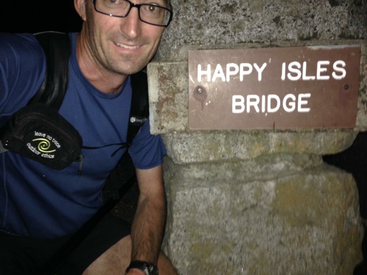
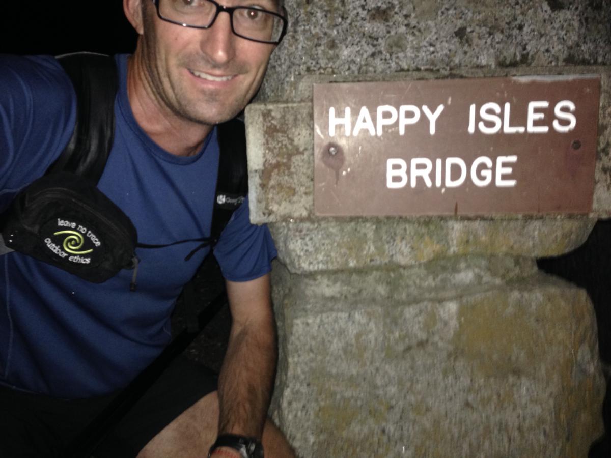
Even though I am not going up the John Muir trail out of the Valley, I start at Happy Isles, in convention with the Northern terminus of the John Muir Trail. After the obligatory start photo, I skirt along the eastern edge of the Valley floor and head up the Snow Creek Falls Trail. I have in my head that someone once said there were 98 switchbacks up this trail. I believe it!
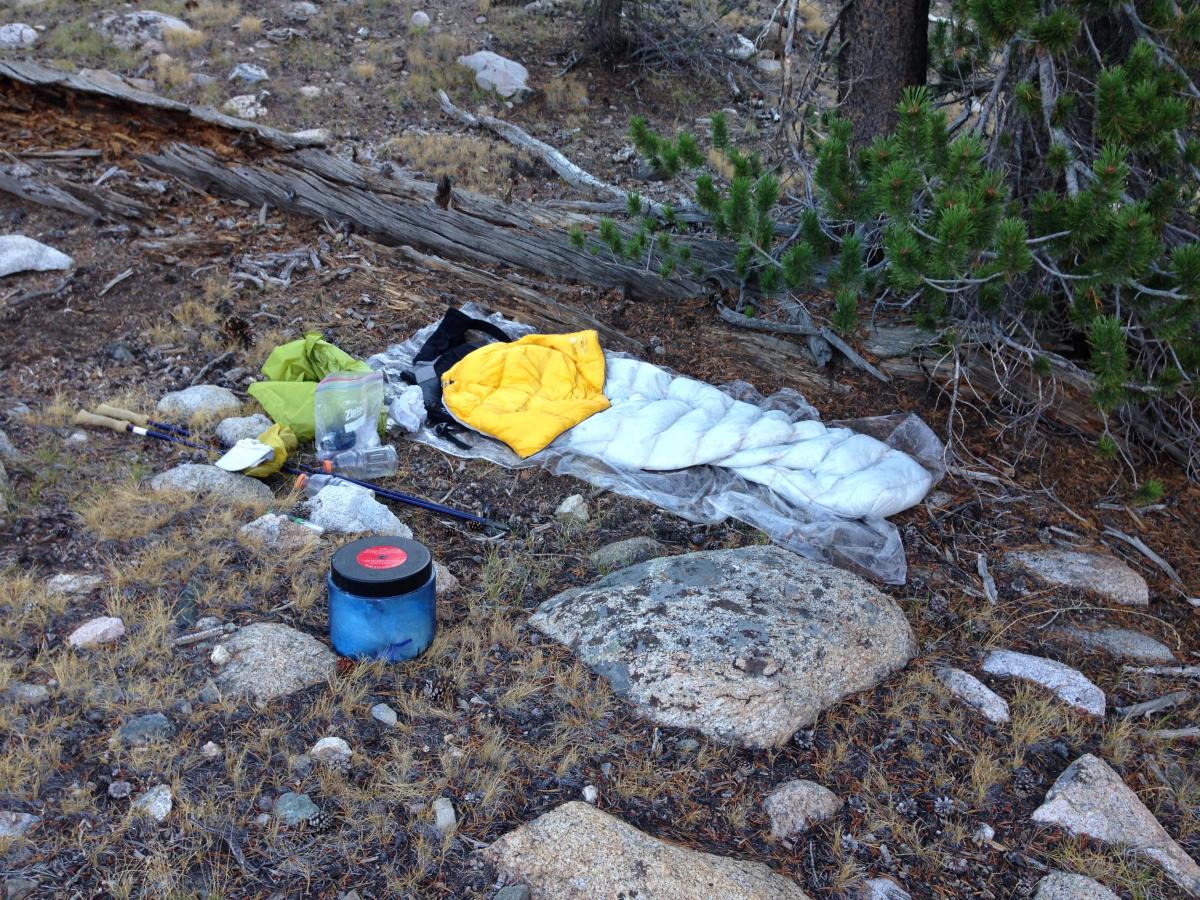
My pack is approximately 19.5 lbs. Who’s counting? I am!! Quite a bit of time and energy and financial resources have gone into lightening my load. I believe this is a huge area for potential performance improvement. You can find my packing list here.
I have been up Snow Creek Falls trail twice before, and down it once. The only time I have seen a rattlesnake in Yosemite Valley was on this trail! As it is incredibly warm for 2 am, this is on my mind. Would snakes be active at this time of night?
I have my shirt off, and I am sweating buckets. Occasionally, there are ash particles drifting along in the smoke that I am hiking through. But it doesn’t seem to be affecting my lungs at all. Naive or lucky, I am unsure, and I press on.
I pass Olmsted Point, and eventually reach the Tenaya Lake junction. Again, I find this trail is closed due to the fire. Even though I know they did not intend to close the trail that skirts along Lake Tenaya, rather only the trails heading into the backcountry, I obey the posted closure and hoof it down the highway to get past the Lake. I rejoin the trail, and quickly take an unintentional detour on a climbers trail. After realizing my errors, I am back on track fairly quickly, and ultimately rejoin the John Muir Trail mid morning.
As I start heading up Lyell Canyon, I mix a Starbucks Via instant coffee with water, and enjoy it cold. Not so bad I think, as I start up the trail with the taste of fresh coffee in my mouth. I fly along this section, covering ground like nobody’s business. Did I mention it has been raining off and on since 6 am? Can’t figure that out, it was supposed to be 20% chance of afternoon showers, and here it is raining in the morning.
Due to exertion, and the continuing uphill trend, I have thus far stayed warm, and am grateful for the lack of direct sun on this stretch. Last year I was too hot, so I’ll take this, although I still don’t understand the morning’s weather, and what if any effect the fire is having.
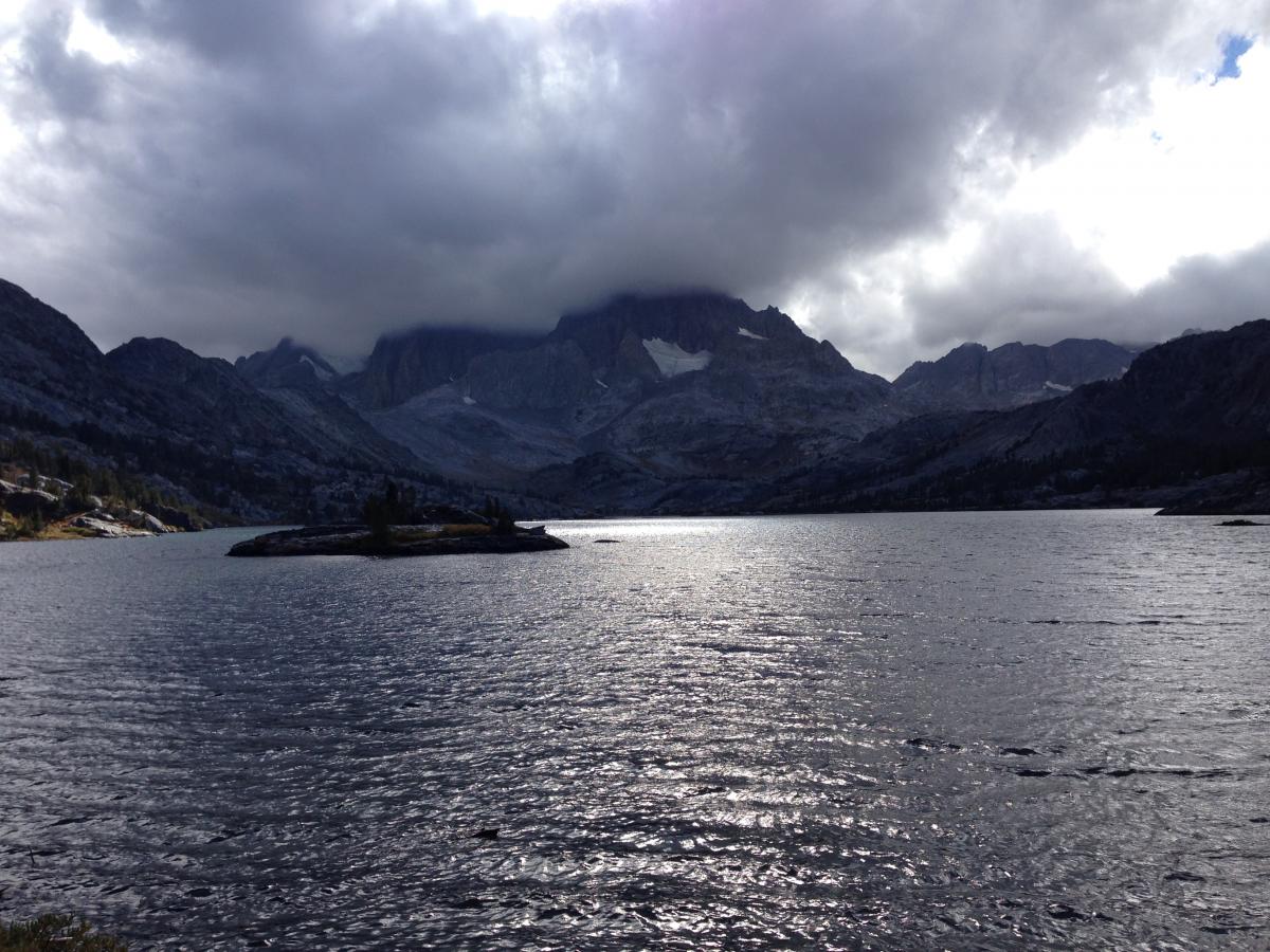
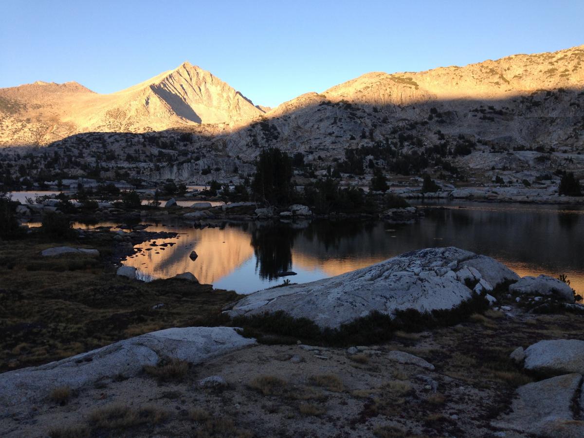
Soon enough, I reach Thousand Island Lake, a true gem, roughly 13 hours after leaving the Valley. Amazing what the body can accomplish! Always pushing on, I continue to gobble up terrain in good fashion. Although, somewhere along this stretch I seem to get stuck in a black hole. I have another Starbucks Via, but it does not even register. The miles from forty to fifty, take an eternity. This section is constantly up and down, passing numerous beautiful lakes, but I can’t seem to make headway against the odometer. Now, I’m cold and tired, and perhaps I drained my batteries too low with those shots of caffeine. The day has been really long!
Additionally, in my softened mental state, the weather is playing with my mind. It was supposed to be sunny with 20% chance of showers. In fact, it was constantly cloudy with what I would call squalls similar to those found at sea. One moment it would be calm, then the winds would kick in, then the rain, sometimes hail, always sideways. I would don my raingear, in an effort to maintain forward progress. It was either that, or constantly seeking shelter behind trees. And then, ten minutes later once it had stopped, I was overheating in my raingear. Stop, shed, and stow the raingear back in my pack. Then repeat all over again!
Nearing Reds Meadow, with great cell coverage, I send texts to two good friends, saying I am cold and tired, and uncertain what the weather is doing?! One immediately responds with words of encouragement, and a switch is thrown. Of course I shouldn’t make any decisions in this tired and cold state. Press on for the day’s goal, and evaluate tomorrow. I can always bail out then if necessary. But no reason to call it quits so soon. I take note of my weakened fortitude, and how quickly it is righted by belief in me from another. Hmmm!
I press on, actually running some of the downhill gravel trail into Reds Meadow. Making great time, I pass through the confusing intersections I previewed on Saturday. The game plan is coming together, as I ascend towards the Red Cones out of Reds Meadow. About 9:15 pm I am feeling the day, and start looking for a suitable spot to bed down for the night.
With last year’s experience, I know to look for big trees, with years upon years of fallen needles, bark and pine cones at their base. I’m not traveling with a sleeping pad, and this is nature’s best replacement. I find such a spot, and am lights out by 9:30.
The recovery drink I slam for dinner doesn’t sit too well, but after several big burps, I am fast asleep.
Day 1 summary – Happy Isles in Yosemite Valley to past Red’s Meadow, approximately below Crater Meadow, 2:00 am – 9:30 pm, ~58 miles, rain squalls on and off for ~8 hours from Lyell Canyon to Garnett Lake.
Day 2, Tuesday September 9th:
My alarm goes off at 2:00 am, and I am moving by 2:15. I think I can do better than this, but don’t remember how quick my transitions were last year. My simple logic is that I need to be moving or sleeping, and anything in between is wasted time.
Immediately, as I traverse the hillside towards my first creek crossing I am struck by how cold it is! Cold temps always follow the drainages, but this is ridiculous. I have everything but my light down jacket on, and I am freezing! I once frost nipped my nose in a Winter Adventure Race, and this feels very similar. There is ice and frost everywhere. Brrrrr!
And, I can’t seem to get my motor up to speed. I’m cold! I’m tired! I try to press on, in the hopes that my exertion will warm me up. It doesn’t!
At 4 am, I find another good spot to throw my bag down. I crawl in, fully clothed (shorts, short sleeve top, long underwear top and bottom, light down jacket, rain gear top and bottom, and fleece hat) and sleep for two hours solid!
No alarm, but I wake up a new man, and find my motor that was eluding me earlier this morning.
I get up to speed and feel I must be making great time. I am reluctant to check my maps on my phone, due to the battery fears instilled on Sunday. On Day 1, my battery slowly went from 100% down to 66%. On Day 2, I elect to turn the phone off, rather than just use airplane mode. On two previous backpacking trips this past Summer, I successfully used airplane mode, ending with ~60% battery after 3-4 days. Clearly something has happened to my battery. Really? Right before my big objective?! Of course, I reason, get over it and adjust, that is the only thing to do at this point. But, damn!
Eventually, I come across a trail sign that tells me that I am not making good time at all. Silver Pass is still a ways ahead. High Sierra signs are notorious for their “approximate” mileage. One sign will have you feeling on top of the world, the next, like your legs are encased in concrete. I know not to put too much mental bandwidth into this, but it still registers with a thump on my psyche!
I also come to realize that with paper maps, I constantly refer to them and tick off features and landmarks as I pass. I always know where I am within a very tight area. Now I am flying somewhat blind, relying only on my constant movement to present identifiable landmarks. Unfortunately I can’t change this at this point. Lesson learned, reliance on digital maps has unintentionally changed the game!
Eventually over Silver Pass! I meet another fast packer, Robert, as I head down Silver Pass. He is heading up, with a 5 day goal. We spend maybe 5 minutes together, but I leave feeling jazzed beyond belief. There is great power in a shared ambition, and I now feel that energy coursing through me as I press on and over Bear Ridge.
Bear Ridge flies by, and soon I am gobbling my way up Seldon Pass. I pass right by the area I hunkered down during last year’s storms, and am grateful for the sunny weather presenting itself today.
Darkness settles in on my descent from Seldon Pass. My now familiar friend, fatigue, settles in. Combined with the cooler temps and darkness, I find myself in a fight to keep moving. What is this power that wants to control me?!
I find my goal of reaching Piute Pass junction, to be the primary purpose in proceeding forward. I also need water, which will be found at the junction. OK, lesson learned, “evenings are hard”. Darkness settles in, and I have been going for 16+ hours. Prep the mind for that, and have a goal to stick to!
I press on towards my day’s goal, and find water and a suitable warm spot to spend the night.
Day 2 summary – To Piute Pass Trail Junction (included Silver Pass, Bear Ridge, Seldon Pass), 2:00 am ~ 10:45pm with a nap from 4 – 6 am, ~ 52 miles. Freezing cold morning with ice on trail, otherwise great day.
Day 3, Wednesday September 10th:
My watch alarm goes off at 4:00. I left the phone off at night to conserve battery power, after finishing day 2 at 40% battery. I’m reluctant to take off my down jacket, and try to do everything else first. Really there is not much to be done, and the down jacket is to be packed with the sleeping bag in the water resistant stuff sack at the bottom of my pack, but I go in circles looking for something else to do first. 24 minutes later I am on my way.
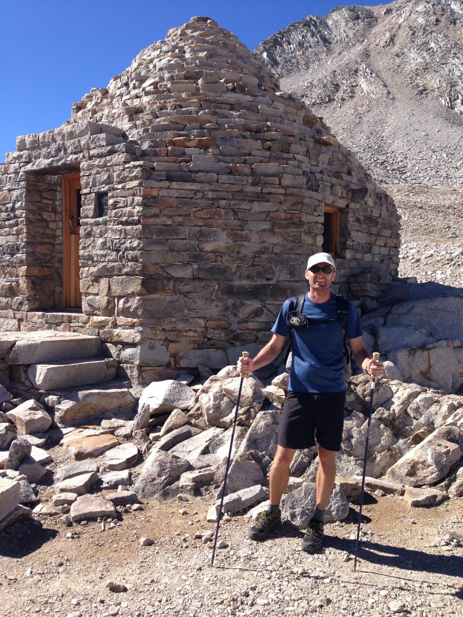
The day starts out with Muir Pass, while only 4,000’ of elevation gain, it is a monster approach of almost 20 miles. No sense avoiding, only to embrace. I also happen to like uphill. I can find a rhythm and push fairly hard for long long periods. I quickly find my internal gear, and cadence with nutrition/hydration.
I cruise up Muir Pass, feeling great. Loving the interactions with hikers that are truly curious about my ridiculously small pack. When folks have questions, I love answering them. One such interaction happens with a super sweet, cheerful couple. They watch as I Steripen a liter of water, drink ~1/4 of it, and then add 3 scoops of Perpetuem to the bottle with my funnel. I shake it vigorously, slam a couple swallows, put everything away, and am on my way in several minutes, all the while explaining my process and answering their questions. Their curiosity and enthusiasm add fuel to my vibe for miles to come. I love interactions like this!
Having done both the slow tour of the John Muir Trail, and now attempting to break the sound barrier, I also know that there is no one right answer even for me. I think I tend to go out of my way to be friendly towards those I am passing on the trail, often being the one to stop early to let them pass.
Leave No Trace Considerations on a speed record attempt:
Obviously, there is an often unavoidable conflict in a speed attempt with minimizing or avoiding impacts. And this quickly boils down to the ethical decisions we all make. I believe that it is not enough to just break a speed record, it must be done in good style. If I break a record, I want it to be something I am proud of, and look forward to having my name attached to. And, I encourage anyone attempting a trail speed record too carefully consider their style.
How and where do you dispose of human waste? At least 100 feet from trails, campsites and water sources is recommended by the land management agencies in the High Sierra. More is better! Additionally, the standard of practice in the High Sierra is packing out all used toilet paper. Having hiked a lot in both Colorado and the High Sierra, I can tell you that the High Sierra has a serious leg up on this. Don't be that person that adds a toilet paper flower in the interest of saving time.
Also, the Whitney Zone is a "no poop" zone. You are required to carry, and use if necessary, a waste containment bag. This also means if you use it, you are carrying it out to the trailhead, thereby adding weight to your pack. Yep, another great place to not save time or weight!
Food storage – Proper food storage is required by law in most areas along the John Muir Trail. It is tough to get a straight answer on whether a bear cannister is required, but if you stop to sleep, swim, or walk away from your pack for a bathroom break – then proper food storage dictates that your food is in a bear cannister. Theoretically, if you were awake and your food is always within arms reach, you are legal.
Beyond legality – when you are so tired that you can't think straight, are you going to properly hang your food where allowed? Are you going to keep moving until you get to one of the few bear proof food lockers found on the trail? Many FKT attempts go this route, and from the comfort of your home, it sounds like a workable plan. My experience tilts me the other direction. I carry a cannister, at a weight penalty of about 2 pounds. The benefits are, I will never contribute to a bear getting accustomed to human food – this is obviously bad for the bear, and bad for any backpackers following in my footsteps. And, I can sleep virtually anywhere and anytime I need to. Given the level of exhaustion that I approach, this is huge!
Other users – I love my time on the trail, and I love to push myself, but you will never find me running up unannounced on a group of hikers pushing my way past. Courteousness goes a long way. Sure, many folks think I am crazy for speeding through such an incredible place, I just want to make sure their experience is not diminished because of it. I will often be the first to stop, and always have a friendly greeting. Part of my experience is found in these interactions along the trail.
Back to Day 3:
I find a friendly guy at the top of Muir Pass, and ask him to take a picture of me, the first non-selfie of the trip! I begin the descent, and am psyched to have miles melting under my soles. On this descent, I pass last year’s bailout to Bishop Pass. I silently nod to the trail sign out of respect, and smile with a deepening conviction rising in myself.
I have a quick conversation with two fast packers having a snack on the trail. One of the two has the same sleeping bag I’m carrying, and we compare notes. I quickly realize how I have played the cards in my favor for a good nights sleep. He has had two horrible nights sleep, but as I learn, camped at 11,000 ft one night, and in a grassy meadow another night. There is such thing as “user error” even with something as simple as a sleeping bag I conclude as I ponder our conversation in the ensuing miles.
Through trial and error, and wisdom gained from reading Mike McClelland’s book, I instinctively look for warm dry spots to bed down. Not so hard when covering huge miles. You just have to be patient, and I have always found a good spot within minutes or so of my ideal stopping time.
Soon, I also pass Little Pete Meadow, where I took one of my favorite pictures back in 2009. I find the same spot, and although a totally different time of day, fall in love with it all over. I wait for my phone to restart from a complete off, and grab a couple more pictures to compare with 5 years ago. I also realize my phone battery is continuing to slip all too fast for my liking.
Still on the agenda for the day, are both Mather and Pinchot Passes. By now, it is high noon, and it is hot! I soak my shirt and hat every time I cross water, but they both dry within minutes! After a full swim near the base of Mather Pass, I find a workable exertion level that is sustainable given the heat, and begin ticking the miles away.
I am struck by how few people I see on this stretch. It is mid afternoon, and I formulate a theory in my mind that most folks go for one pass a day, and they wouldn’t be dumb enough to do it during the absolute heat of the day. The trail is all mine I reckon!
Nevertheless, I begin to pass some parties as I close in on the pass. And just to add an extra smile to an already stellar day, I end up closing in on the top of Mather Pass as the sun is setting, so am constantly staying one switchback ahead of the setting sun.
As I roll over the pass, I pass one more hiker heading up, then no one for several hours. I descend all the way to near Bench Lake. I am cooked. It is 8:30 pm, and if I continue over Pinchot Pass, as I wanted, I won’t get over until the early morning hours, making for an incredibly long day.
I find a good spot, and pull off at 8:30pm, uncharacteristically early for me! As I lay in my bag, I have the same feeling as on the first night, my recovery drink mix is not settling. Regardless, sleep approaches hard, and I am out.
Day 3 Summary – To the bottom of Mather Pass near Bench Lake (included Muir Pass and Mather Pass, but didn’t make it over Pinchot Pass as hoped) 4:00 am – 8:30 pm, ~46 miles, sunny and hot day!
Day 4, Thursday September 11th:
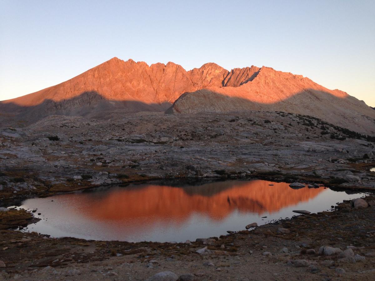
I awake 15 minutes before my alarm at 12:30. That would have been a tad less than 4 hours sleep, but apparently I am keyed up and ready to go. Pinchot Pass is on my mind, and I have the conviction to do it soon. I head up the large basin preceding Pinchot Pass, and quickly rise above tree line. I have been fortunate by chance to time this adventure with a full moon. Tonight is wonderful! While not enough to hike by without a light, I see much more around me, and can hence feel the scenery passing. Good for the mind in the middle of the night.
The night is quiet, an Alpine beauty that is only known by those that willfully buck the desire to be asleep at this hour. The air is cold, crisp, and clear. Moonlight bounces off granite, and the faint light defines the boundaries of my existence in this place and time.
Two coyotes begin to howl. Clearly, they are in this valley with me, although I never see them. I am sure they know exactly where I am. While I’ve never been afraid of coyotes, it does catch my attention as there is nowhere to run and hide. Awesome!
Several folks have asked if I was ever scared of wildlife. In general the answer would be no. I have seen enough black bears, and in every instance have been able to scare them off. I have never seen a Mountain Lion in the High Sierra, but have heard enough stories, that it crosses my mind. Curiously, an individual had gone missing last year near Red’s Meadow. There are still laminated signs posted at trail intersections in this area. Passing these in the late night or early morning darkness was always a little unsettling. Perhaps it was a mountain lion, and perhaps it is still out here!
Several times in the dark, I spooked animals that I couldn’t see. I would hear them rushing off in underbrush off the trail. Logic told me that these were deer, maybe a bear. But as long as they were running away from me, I shouldn’t be afraid. I also have a notion, not sure if right or wrong, that mountain lions don’t venture above tree line as there isn’t as much prey that high. For this reason, I was quite happy to be working my way into the higher elevations as my trip went on.
Staying in motion, I quickly send Pinchot Pass, and roll into the descent that goes on forever, to enter the Rae Lakes Canyon. Around 6:00am, I feel immense fatigue catching up with me from my 12:30 am start. Once again, I pull off and find a suitable spot under the trees for a much needed nap. Again, no alarm, and I wake ready to go in an hour.
I still have a huge day ahead… Glen Pass, Forester Pass, then Whitney summit. I am keenly aware that sleeping is not getting me there.
Rae Lakes is an area that I would love to spend a week in. Absolutely quintessential High Sierra beauty all around! Curiously, when passing between the two lakes on the narrow spit of land, I get a strong smell of tomato plants. A really strong smell, like I am in my garden at home pulling on the limbs of my tomato plants. Weird! I soon pass a group, and comment on the distinct smell. One person in the group excitedly agrees, but has as little clue as I where it originated from.
I fill up on water and begin ticking off the miles up Glen Pass. The brief nap is paying dividends now as I feel like I am running on all cylinders as I head up the pass. I pause briefly to take in the views from the top, and converse with others enjoying the airy vantage point, and then down I go.
I am thankful for the easy miles on the downhills! Soon enough, I am beginning the long approach to Forrester Pass. My plan is still to roll over Forrester and then continue all the way to Whitney summit today. Since I had started in Yosemite Valley at 2:00 am, I have in the back of my head that I need to reach Whitney Summit before 2:00 am to finish in under 4 full days. At this point, I am ~30 miles from Whitney’s summit with Forrester Pass in between me and my objective. It is now early afternoon, and I think it doable, but I really just want to take another nap.
I am tired, all over tired. My feet are tired, and my mind is tired. I don’t want to contemplate how much water I need, or how many calories I should be taking in. I want to sleep. I pass all sorts of good nap spots. My pace is slowing, and then slowing faster. I wander over to the creek paralleling the trail. I sit on a rock, lost in fatigue. I realize that if I sleep, I won’t make the sub 4 day goal. I want to sleep, but I gather myself and continue on.
I go the 100 feet back to the trail, and promptly sit down on another rock. I am worked, physically and mentally. For five minutes, maybe ten, I weigh my options. Pressing on, trying to reach my goal despite the enormous fatigue that is turning my world grey. Or, giving up on my goal and taking care of my fatigue and resetting it with a quick nap. I can’t seem to make a decision, and time is passing.
And then, it is as if, I am hit by an external energetic force. A switch is turned, and an almost unbelievable conviction arises within. I KNOW WITHOUT A DOUBT, that if I get up and go, I will make it to Whitney Summit before 2:00 am. With that, all fatigue is gone. It is game on, and I am a new man as I begin the ascent of Forrester Pass.
Few times in my life have I ever had an experience even close to this. Looking back, this is a “magic moment” that truly stands out in my 43 years of life, and gives me goose bumps even as I write this! Forrester Pass rolls under foot, and soon I am standing on the top, ready to send the rest of the afternoon’s goal.
From the top of Forrester Pass to Whitney summit is ~25 miles. I am on my fourth day, and have covered ~187 miles thus far, but I float down the trail with my new found conviction and confidence.
Soon I reach the undulating approach to the West Side of Mt Whitney. The afternoon turns towards evening. The effort appears to be catching up with all of me. My left wrist begins to ache from the hiking pole. Of course I realize, as I haven’t trained with the poles once this year, and now I have spent close to 20 hours a day over the last three days using them. This pretty quickly turns into a small half lemon on my wrist as swelling takes hold.
More unwinding… my phone battery dies completely as I consult it at the few trail intersections leading up to Guitar Lake. Wishing strongly that I had brought paper maps, I know the only thing to do is press on to the next trail intersection to confirm that I am headed in the right direction. Standing still, wondering will not answer my navigation questions.
In a short bit, I stop for the bathroom and am surprised to have diarrhea. I use the last of my toilet paper, ack! My energy is still good, but my belly begins to feel a bit off. Maybe the food, or really the lack of solid food for last several days.
As I pass the Crabtree Ranger Station turnoff, there is a Rubbermaid bin with WAG Bags along the trail. Mt. Whitney is a no poop zone, so hikers are required to carry out all solid human waste with them. I think this is a good thing given the number of folks that travel through this high alpine area, and I am relieved grabbing a Wag Bag knowing that there is toilet paper in them 🙂
Now, some seven hours after my bolt of energy, I am starting to feel the day. But I am also within spitting distance at this point. As evening and darkness approach, I break the remainder into three segments: 1) the final approach to Guitar Lake, which is the last camp for most folks traveling this direction, 2) from Guitar Lake there is a series of switchbacks that climb 2,000 feet up the West side of Mt. Whitney, and 3) the final “traverse” to reach the summit (this stretch also gains ~1,000 feet in elevation.)
Darkness fully descends as I lean into the first section. I find that running my headlamp on full brightness alleviates the creep of sleepiness that I begin feeling. I reason that has to do with the extra inputs from seeing the peripheral scenery passing by, as opposed to hiking in a narrow tunnel of vision on the low light setting. I calculate that I should have enough battery juice, as I just put my spare set in the evening before.
My stomach continues to revolt. At this point, I am having full conversations with my stomach. And, for some reason, in my mind, it becomes a separate entity from myself. “Look stomach, you need to eat! Look, we are eating. You need to eat”. Calorie consumption was definitely going downhill.
I also assign responsibilities along this stretch. My left leg is in charge of the approach to Guitar Lake, my right leg the switchbacks, and then I’ll take over for the final traverse. Don’t laugh, this all makes perfect sense to me at the time.
At the thin streams trickling into Guitar Lake, I fill up both bottles, knowing I have to get up and over Mt. Whitney before I will find water again. I steripen the first bottle, and add my drink mix. I try to steripen the second, but the batteries in my steripen call it quits. Apparently I just hit the 50 liter mark, as that is what a set of batteries are meant to treat. My spare batteries are the ones in my hand held flashlight that I use for backup light and added depth perception on the trail as necessary in the dark.
I make a decision that I don’t want to swap the batteries right now, and will deal later. The tents of others that I pass are all lights out as it is now fully dark. I continue to do math in my head, and know that I am going to make the summit prior to my 2:00 am goal.
I head up the switchbacks, with my two legs, and wobbly stomach as companions. Another imaginary person joins us, and is in full tour guide mode pointing out the features of the switchbacks we are ascending. This “person” is totally fictional in my head, but makes perfect sense in the moment.
I still have a very difficult time convincing my stomach to consume much of anything, but manage to finish the first bottle by the time I reach the top of the switchbacks at the Whitney Trail junction.
Fatigue has also returned with a fury. All of me is exhausted beyond belief. Add to that, it is now officially cold, and I can’t get my head around taking the time to swap the batteries from my handheld light to the steripen and back again. As I reach the traverse at the top of the range, the wind reaches a steady and fearsome howl.
Did I mention that my headlamp is now down to a faint glow? I am a truly aching unit. My calorie consumption is way below what it should be, and I am freezing. I slowly don all my warm clothes, and struggle to stay awake every time I stop to add another layer. I fall asleep sitting in the middle of the trail, on rocks, and once even while leaning over my poles to stretch my hamstrings.
And all the time I know I must keep moving. Often this knowledge is probably the only thing that does in fact keep me moving. At some point on the traverse, I stop to add my down jacket. I now have everything on. And, I am freezing. I am using the handheld light to guide my way, and am constantly stumbling over rocks. Swapping batteries in order to treat my remaining quart of water is no longer an option. I should have done it while I still had a working headlamp, and was reasonably warm.
The trail feels sketchy. I feel that if I misstep, I will go over the side into the dark oblivion. I fully have my sights on the summit, both in order to make my time, and also to seek shelter in the hut atop Mt. Whitney. I am dangerously cold at this point, traveling uphill. To stop or head downhill would send me deeper into a danger zone I want no part of.
It occurs to me that if I were to break an ankle, “we” would be in serious trouble! In the same moment, I realize that the “we” is really just me. There is no one else here. I am in this alone. Looking back, I can wonder about the psychology behind the separation of my body parts into separate selves? Here I had been hiking along with my companions my left leg, my right leg, my stomach (the slow one), and a mystery tour guide. My moment of clarity vaporized this all, as I realized the precarious position I had put myself in.
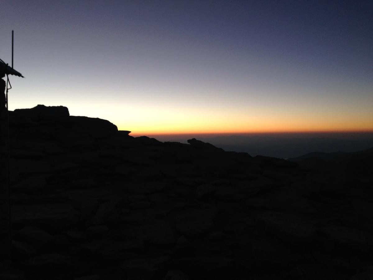
I check my watch often, and through fuzzy math, realize that I am still on target. I stumble on. I have been up Mt. Whitney numerous times over the years, and this stretch feels familiar. I know when I am getting close, and on the final shoulder to the Summit. This brings energy from somewhere, and I soon find myself at the Summit. 3 days, 23 hours, and 11 minutes after leaving Yosemite Valley!!
I check the door to the hut, and am relieved to find it open and unoccupied. I pile in, and fall to the floor. I size up the scene and realize I will be sleeping on a hard wood floor with no pad, and my very light down bag. Outside it is freezing cold, and howling wind, but in here, I can make it work. I try my steripen again, and find that it goes for about half the recommended time. Good enough I decide. I mix a half portion of the recovery drink mix, knowing that my belly is still unsettled. I drink that, and am in my bag in 10 minutes or so.
I fall asleep hard, only to wake with an all consuming urge that I must throw up now!! In a seamless move, I launch both hands through the narrow sleeping bag opening at my face, pulling it all the way open. I grab my gallon Ziploc with small items in it. In one motion I dump those out on the floor, and bring the bag around to my mouth in time to unload all that I have consumed over the last several hours. Yuck!! And, thank god I made it into the bag. That could have been bad. I seal the bag and toss it near the door, while never getting out of my bag. I gingerly lay back down and begin to get settled, only to repeat the process once more. This time with a smaller quart size bag from my drink mix.
This could be a long night I think. But, thankfully that was all.
Day 4 summary – To Whitney Summit (included Pinchot Pass 2,300ft, Glen Pass 3,500ft, Forester Pass 3,600ft, and Mt. Whitney 4,900ft) 12:00 am – 1:11 am, with a nap 5-6? am after Pinchot Pass. Freezing cold at Whitney summit with howling winds. Way low on calories, and overall systems going to failure.
Day 5, Friday September 12th:
I slept somewhat well for 4 hours, until I wake up with an URGENT need to poop… NOW!! I grab the WAG bag, ripping it open, quickly making sense of all the parts. I quickly debate pooping into the bag here in the shelter, or braving the elements to not foul the air of the small space of the hut. I elect to duck outside in the howling wind to do my business. As I step out of the door, I see two headlamps approaching along the broad shoulder to the summit where I am. I duck around the back of the hut, only to have the wind almost snatch the WAG bag from my hands. Back to the front, sheltered from the wind. I make a quick decision that the headlamps are far enough off, and moving slowly enough to give me time.
Gross alert! Diarrhea like crazy! Thank god for the WAG bag. I get my scene back in order, add the vomit bags from the night before to the WAG bag, and leave it tucked outside the door. I retreat back into the shelter of the hut, and the other two hikers soon arrive.
It is a little after 5:00 am, and soon a few others arrive. There is little conversation at this early hour. I think everyone is excited to be at the summit, and sheltered from the elements for the time being. After dozing briefly, I pack my things and am ready to head down as soon as there is enough light. For kicks, I try to turn my phone on, and am surprised to find it has a little juice left.
I take a picture outside with the summit register, and then of the sunrise unfolding on the eastern horizon. I then grab my pack and begin the descent. What felt terrifying last night, actually feels fairly tame in the growing daylight.
I feel physically worked over, but now emotional energy is coursing through me. Tears come and go on this stretch, free flowing at times. I have dipped deep into my emotional well, and am enjoying being immersed in the experience. I am so incredibly thankful for the people in my life. Thinking of each new person brings on a fresh wave of tears. So much goodness!
Mixed in with my own very personal experience is a trail full of people 🙂 Thankfully the downhill travel is easy, and I am passing countless others on their way to the Summit. One man remarks that I look fresh as daisies. I smile and laugh out loud!
The descent from the summit of Whitney to Whitney portal is ~10 miles. Most people attempting a fast time on the John Muir Trail report both their time to the summit, and also to Whitney Portal. So officially I am still on the clock for the second time, but I am in savoring mode at this point! I try to jog in a couple places, but am definitely not feeling it.
My well used Wag bag is in the outer mesh pocket of my backpack. At some point on this stretch it begins dripping on my calf muscle. Ack! Talk about grosser that gross!! I put the whole thing in another gallon Ziploc, and continue on.
The emotions continue to come and go, and swirl all around me. Given the precarious nature of my belly, I gingerly sip on my drink mix, and probably only consume 200 calories on the descent. I know I am way in a hole calorically, but it won’t stop me now.
As I near the trailhead, the tears won’t quit. A lot is coming up for me, and all of it is good! Truly a magical human experience!
I have a quiet internal celebration as I hit the pavement. Done! I beeline for the special trash cans designated for the wag bags, and gratefully unload my package. I find a spot in the shade to sit down on the curb. It occurs to me that maybe I will have enough phone battery juice to take a final “after” picture. Sure enough, it turns on with 2% battery registering. A man walking by is nice enough to take my picture. As he hands the phone back, a handful of text messages come across from friends that had been watching my progress on the Spot GPS tracker. Again I am brought to tears, and laugh as I quickly try to respond to each before the battery hits zero.
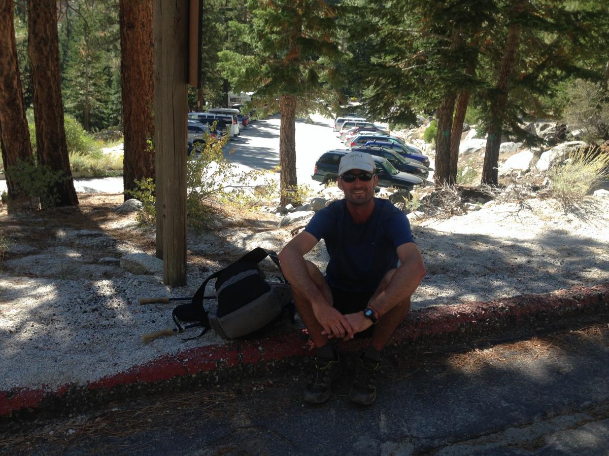
Total elapsed time from Yosemite Valley to Whitney Portal: 4 days, 8 hours, 12 minutes. ~221 miles. The previous unsupported southbound record was 4 days, 8 hours and 43 minutes. I beat that time by over 9 hours, but will accept that my time has an asterisk next to it due to the detour leaving Yosemite Valley on day 1 due to the fire.
In the hours, days, and weeks since then, I have enjoyed reliving every moment of this adventure. I love my mind and my body, and what the two are capable of. And yet, I am still curious as to when I will find my limits!
______________________________________________________
And, now a request … to join me! In something bigger than even my next adventure. The Leave No Trace program is focused on reducing or avoiding user impacts in the places you and I love. I personally make a financial contribution to Leave No Trace every year. I know that might be odd, because Leave No Trace is also my employer, but it is important to me! I cherish my outdoor experiences growing up; with my family, with Boy Scouts, and Outward Bound. All of these included a strong sense of taking care of our wild places, an ethic that is probably largely responsible for my path in life up to this point. This is a message and way of life that Leave No Trace is now reaching millions with annually. Please join me in protecting the future of our favorite places by donating today!


